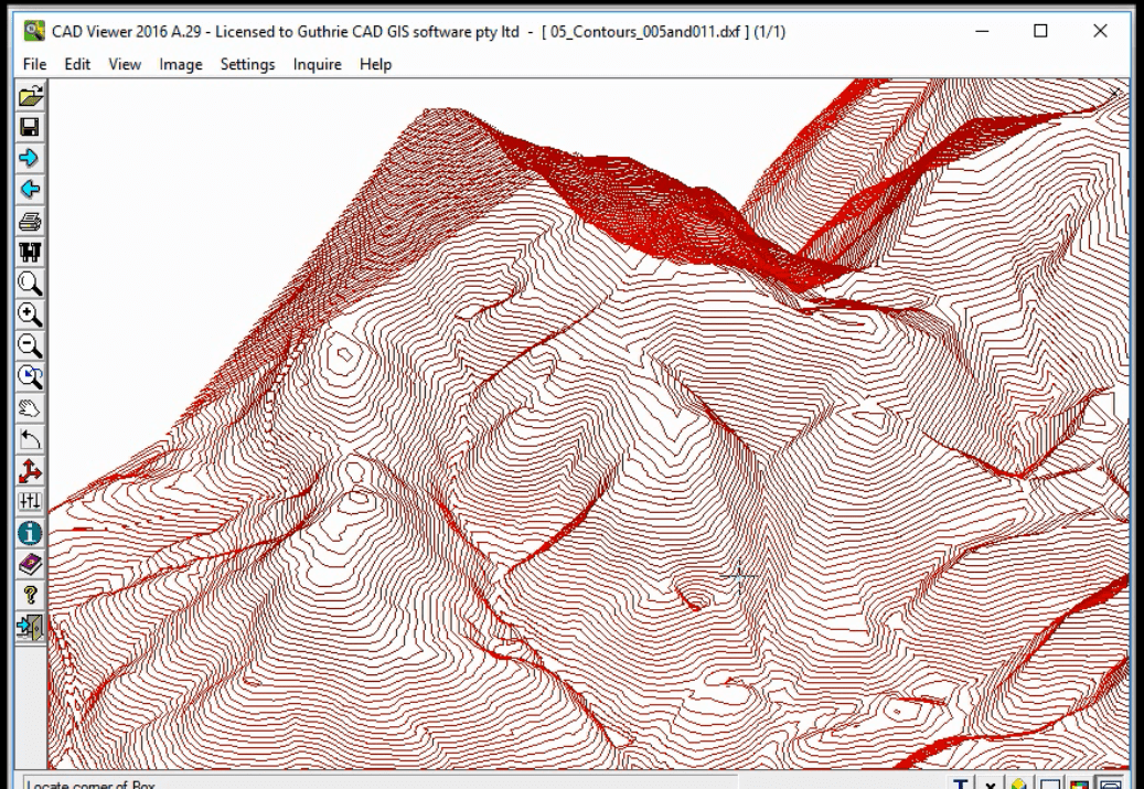
Convert elevation data as real 3D Z coordinates
Arcv2CAD Converts elevation data as real 3D Z coordinates
By using this function, elevation values which are included as table data for 2D shapefiles can be used to generate real Z coordinate values in the output DXF/DWG file.
The output DXF file will contain actual 3D geometric entities.
STEP1: First, choose a SHP file with contour (elevation) data.
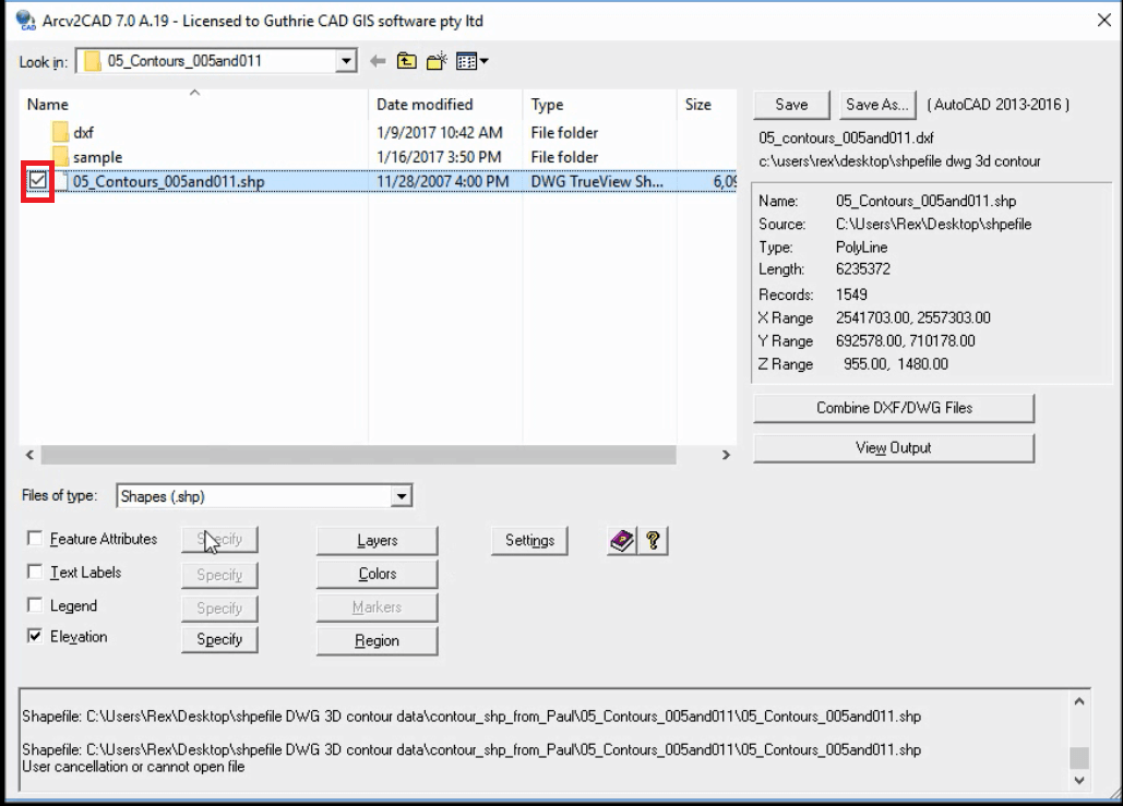
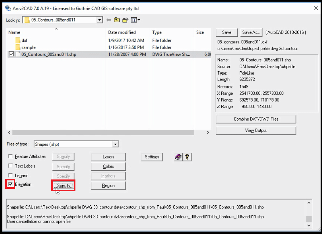
STEP2: Tick "Elevation" and press "Specify" button.
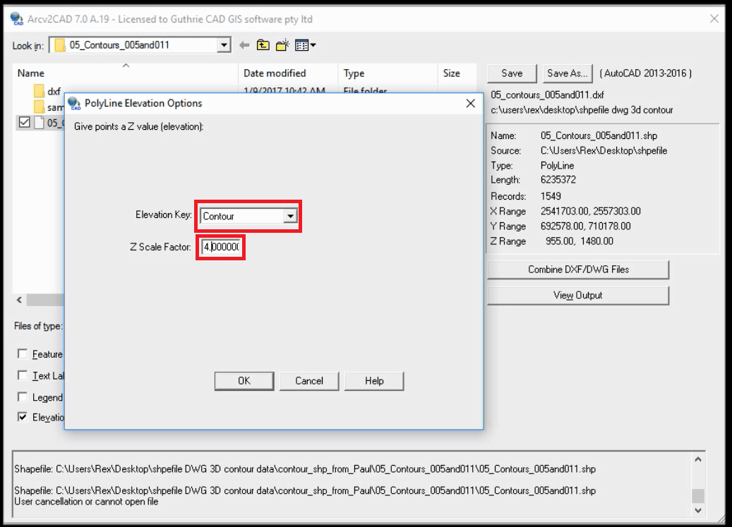
STEP3: Select "CONTOUR" and input 4 on Z scale factor.
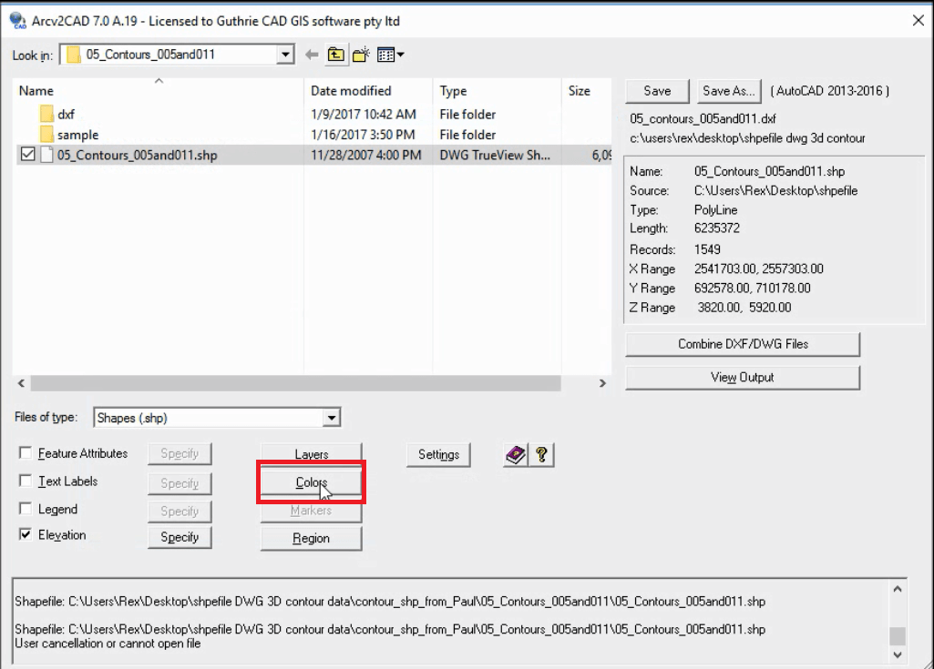
STEP4: Press "Colors" button.
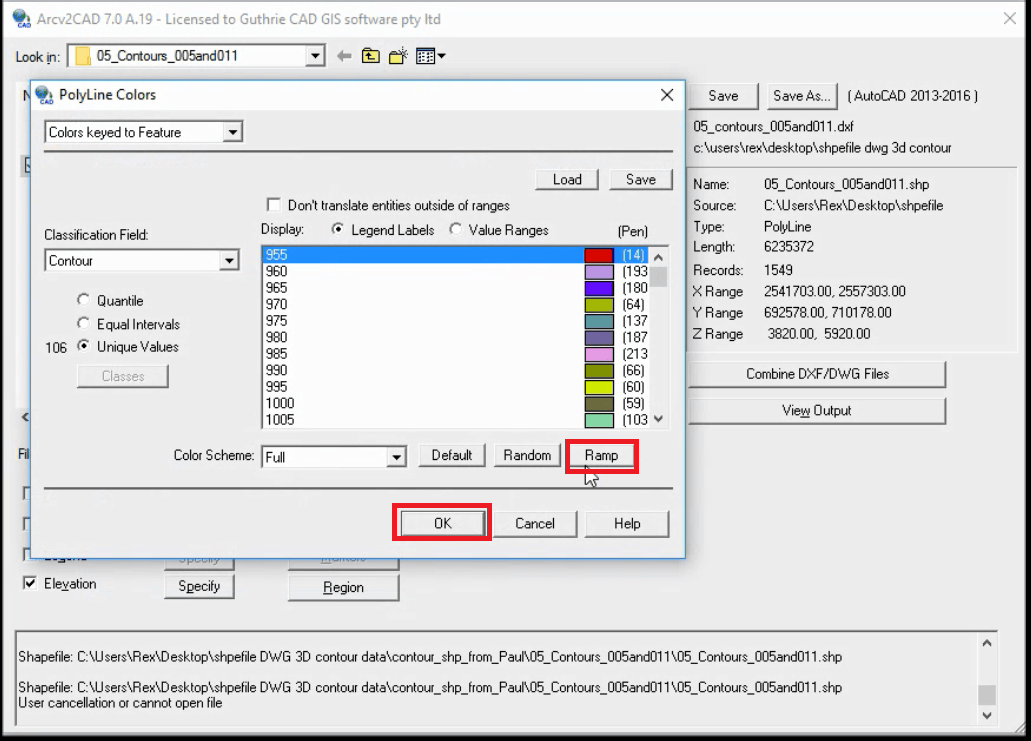
STEP5: Press "Ramp" button and OK button.
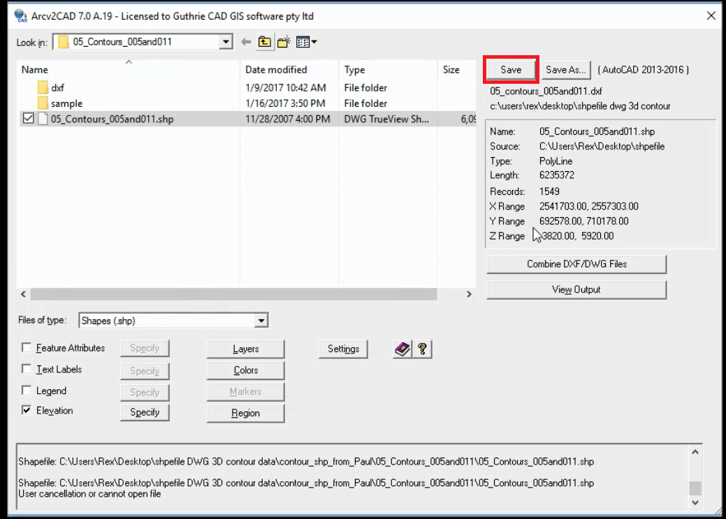
STEP6: Press "Save" button. Then the conversion will start.
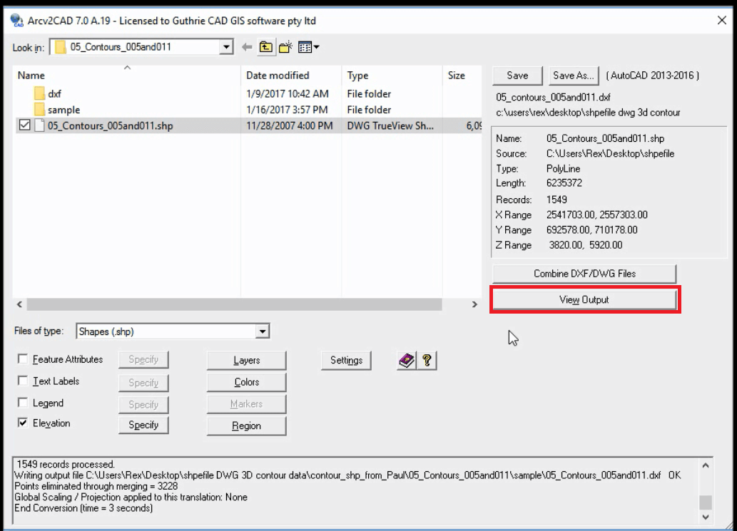
STEP7: When the conversion is completed. Press “View Output” button.
STEP8: You can see a converted DXF file on CAD viewer software.
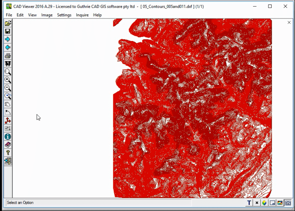
STEP9: Use zoom-in (box) function to have a closer look at one particular area.
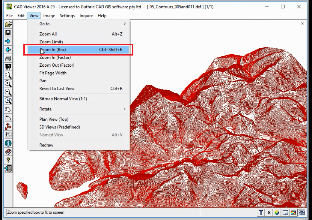
STEP10: Now you can see beautiful contour data on AutoCAD drawing.
